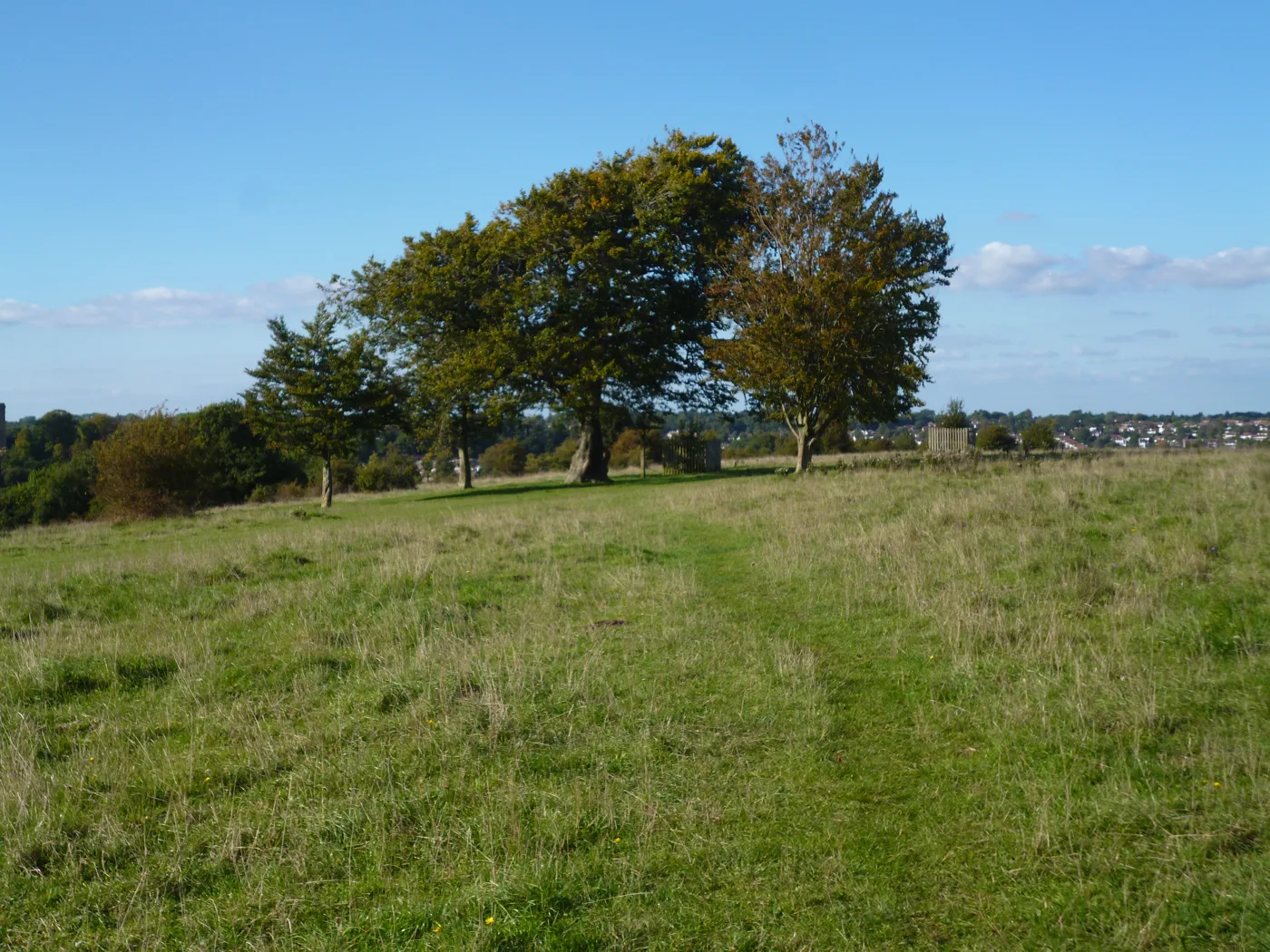

Farthing Downs, the London Loop, Addington Hills and the Wandle Trail lead 13 walks near Croydon, with distances, mud, parking and stations, checked Oct 2026.
The walks most people near Croydon start with are Farthing Downs and Happy Valley in Coulsdon, open chalk downland with a 3 mile circular route; the London Loop through Addington Hills, Selsdon Wood, Riddlesdown and Kenley; the Capital Ring over the hills of Upper Norwood; and the Wandle Trail, which follows the river from Croydon to the Thames. Every entry was checked against the owner’s or the route’s official guidance on 26 October 2026.
We have not walked these routes for this guide, and nothing here is a rating. Each entry sets out what the people who own, manage or map the route publish: distance, the ground underfoot, mud, toilets and cafes, parking, and how to get there and back. The long waymarked routes come first, then the downs and commons in the south of the borough, then the woods and parks you can walk round in an hour or two. October to March is mud season on the chalk and in the woods, so the warnings below matter more than usual this week.
The long waymarked routes
London Loop section 4, West Wickham Common to Hamsey Green
The Loop’s woodland section across the east of the borough: 8.6 miles, or 9.3 miles (15km) with the walk from Hayes station, according to the Ramblers’ guide for Transport for London (revised December 2024). The Ramblers describe “a fair amount of climbing, rewarded by some splendid views”. From Coney Hall it crosses into Croydon through Threehalfpenny Wood, then passes Shirley Windmill (built in 1854), the viewing platform on Addington Hills, Bramley Bank nature reserve and Selsdon Wood. The guide warns that many of the original waymark posts have rotted and are leaning, flat or missing, so take the map. There is a cafe with toilets behind it by the pitch and putt in Sparrows Den playing fields. You can cut the walk short at Upper Shirley Road, at the Coombe Lane tram stop after 4.2 miles, or at Addington Road. It ends at Hamsey Green, where the 403 bus runs to Sanderstead and Croydon stations.
London Loop section 5, Hamsey Green to Coulsdon South
The Ramblers call this “a very attractive section”: 6.4 miles (10.2km) from Hamsey Green across Riddlesdown, Kenley Common, Coulsdon Common, Happy Valley and Farthing Downs to Coulsdon South station, per the Ramblers’ section guide. Much of it is level, but there are “some very steep slopes both up and down”, including a flight of 28 stone steps and 55 wooden steps up to Kenley Common, and parts “can be very muddy after wet weather”. It passes the Riddlesdown quarry viaduct, built in 1884 for the line to East Grinstead and Oxted, and the edge of Kenley Airfield. The Fox on Coulsdon Common is on the route, and the Wattenden Arms, which the Ramblers say is full of Second World War memorabilia from the airfield, is just off it. Public toilets and parking at Farthing Downs. Buses from Godstone Road and Coulsdon Road let you split it in two.
Capital Ring section 4, Crystal Palace to Streatham
The Capital Ring’s run along the north edge of the borough: 4.2 miles, or 4.4 miles (6.8km) with the station links, from Crystal Palace station to Streatham Common, according to the Ramblers’ guide (revised December 2024). They describe it as “a ‘rollercoaster’ among the ridges and valleys of the former Great North Wood”, almost entirely on pavements and tarmac with one short rough path and “some fairly steep ups and downs”. It goes through Westow Park and Upper Norwood Recreation Ground, down Biggin Hill into Biggin Wood, a remnant of the Great North Wood, then up through Norwood Grove, where the Grade II listed mansion was built in the 1840s by Arthur Anderson, a founder of P&O. Dogs are not allowed in parts of the Norwood Grove garden, but there is a signed way round. Toilets beside Westow Park and at the Rookery Gardens cafe.
Wandle Trail, Croydon to Wandsworth
A 12.5 mile (20km) walking and cycling route that, in Merton Council’s words, “follows the route of the River Wandle from Croydon to the Thames at Wandsworth”. It starts at East Croydon station, according to Wikipedia’s account, which also notes that the river runs through largely built-up land and that some stretches leave the bank for nearby roads; where cycling is unsuitable the trail splits into a walkers’ path and a road route. Part of it is National Cycle Network Route 20. In Croydon it runs through Wandle Park, where the council lists a cafe with toilets inside and a tram stop of the same name. Further on it passes Morden Hall Park and Merton Abbey Mills. Stations along the way make it easy to walk in sections.
Vanguard Way, from East Croydon station
The Vanguard Way runs 66 miles (107km) from East Croydon station to Newhaven on the Sussex coast. Its own route overview says that from the station “you soon reach parkland, woodland and open country, passing several historic houses at Coombe, through Selsdon Wood Nature Reserve” and on to the church of St Mary the Virgin at Farleigh, before a strenuous climb to the North Downs at 260 metres. The route was created by the Vanguards Rambling Club and established in 1981; the Ramblers’ Loop guide explains the name came from a 1965 outing when the club had to ride home in the guard’s van. Directions in both directions and GPX files are free on the route’s site, so the opening miles to Selsdon Wood can be walked as a stretch on their own.
Downs and commons in the south of the borough
Farthing Downs and Happy Valley, Coulsdon
The walk most people in the south of the borough mean. Surrey County Council’s circular route is 3 miles (5km), takes about an hour and a half, and starts at the Farthing Downs car park on Ditches Lane, CR5 1DA. It lists “one flight of steps, no stiles” and warns of climbs and descents “on chalky surfaces that can be slippery”. Both sites are Sites of Special Scientific Interest, designated a National Nature Reserve in 2019. The City of London, which owns Farthing Downs, adds a nature trail you can follow as an audio trail and a Downlands Circular Walk of 3 or 6 miles. Pay and display car park open 7am to dusk; toilets, including an accessible toilet, at the car park. Cattle, including a bull, and sheep graze all year: keep dogs on a lead in sheep fields. Coulsdon South station is about five minutes’ walk via Reddown Road.
Riddlesdown, Kenley
Chalk grassland and ancient woodland “scattered with evergreen yew trees” above the Godstone Road, in the City of London’s description, with valley views and paths on into the countryside. There are many possible routes and no single waymarked circuit; the London Loop crosses it on the way from Hamsey Green to Kenley. The small pay and display car park is off Riddlesdown Road, which leads off Mitchley Avenue, and opens from 7am until dusk. The City’s tariff, updated July 2026, is £1.50 for up to two hours or £3 all day on weekdays, and £3 at weekends; cameras record number plates, so pay on arrival. Riddlesdown station is a short walk to the north, and the 407 bus stops on the Godstone Road. Cattle and sheep graze here too, and the City warns that paths can be “slippery, wet and muddy” in winter.
Kenley Common and Kenley Airfield
The City of London calls this “the most intact fighter airfield associated with the Battle of Britain”: about 1,000 service personnel were stationed at RAF Kenley at its height, and many of the surviving blast pens and structures are now scheduled ancient monuments, sitting beside chalk grassland and coppiced woodland. The common was requisitioned for an airfield in 1917; the City had bought it in 1883. The Ramblers note the airfield is still used by the Ministry of Defence, with an RAF memorial and information boards. There is no public car park: the City points drivers to the marked bays on Hayes Lane. Kenley, Whyteleafe and Upper Warlingham stations are each about 15 minutes’ walk away, and the 409 bus (Monday to Saturday) stops at Buxton Lane and Ninehams Road.
Woods, hills and parks
Addington Hills, Upper Shirley
A 130 acre heathland plateau of heather, birch and pine that rises to 460 feet, according to Croydon Council, whose history notes say the land was bought in four stages between 1874 and 1919. The viewing platform at the top was given in 1963 by Alderman Basil Monk to mark Croydon’s millenary; its low wall is engraved with direction lines to landmarks, and the Ramblers say that on a clear day you can see Windsor Castle, 26 miles away, as well as Wembley and Canary Wharf. Open at all times. Car parks off Shirley Hills Road and Oaks Road at the junction with Coombe Lane; the nearest tram stop is Coombe Lane. Cycling only on the bridleways. The London Loop crosses the hill, and the Ramblers’ guide notes a Chinese restaurant at the top.
Selsdon Wood Nature Reserve
Two hundred acres of woodland and open meadow owned by the National Trust and managed by Croydon Council, with ponds and a shelter. The council’s history says local people raised the money to buy it by public appeal after the Selsdon estate was broken up in the 1920s; the Lord Mayor of London, Sir Percy Vincent, opened it on 5 June 1936 as “a link in the Green Belt encircling London”. The old shooting rides laid out in the 19th century can still be seen. Main entrance and car park, with bays for disabled drivers, off Old Farleigh Road, CR0 9HW. Both the London Loop and the Vanguard Way pass through it, so it links easily to longer walks.
Croham Hurst, South Croydon
A wooded hill and Site of Special Scientific Interest of about 85 acres between Upper Selsdon Road and Croham Hurst Golf Club, per Croydon Council. The council’s history says it was bought from the Whitgift Foundation in 1901 after a three-year struggle, that its top stands some 477 feet above sea level, and that two Mesolithic hut sites were found there in 1968, along with a Bronze Age round barrow. A public bridleway runs along the north-eastern edge from Bankside, opposite Winchelsey Rise, to Upper Selsdon Road. No cycling except on the bridleways. Address for satnav: Upper Selsdon Road, CR2 0DW. The council lists no car park, toilets or cafe.
South Norwood Country Park
A 125 acre local nature reserve of wildflower meadows, wetland and a lake, with a viewing mound, between Albert Road and Elmers End Road, according to Croydon Council. It was a sewage farm until 1966 and opened as a country park in 1989; the council says more than 100 bird species are recorded there each year. The Waterlink Way cycle path runs through it. Main entrance and car park, with disabled bays, off Albert Road, SE25 4NF; Harrington Road tram stop. Before you go: the toilets are closed for refurbishment, the visitor centre has been shut since an arson attack, and the Kiosk Community Cafe opens on Saturdays only, 9am to 2pm.
Lloyd Park and Coombe Wood
Two neighbouring council parks a short tram ride from the town centre. Lloyd Park is 114 acres of parkland, mature trees and woodland beside Coombe Road, with a cafe, a small pond, its own tram stop and a car park off Coombe Road giving three hours’ free parking with a ticket from the machine. Next door, Coombe Wood is 14 acres of woodland and ornamental gardens with a cafe, a pond and waterfall, and a council leaflet with a guided route round the grounds. It holds a Green Flag Award. Coombe Wood closes at night, bans cycling and does not allow dogs in the gardens; parking in Conduit Lane, CR0 5RE.
How we chose
These are the routes and open spaces people search for around Croydon, chosen because they are waymarked national or regional trails or because the council, the City of London or the National Trust manages them for walking. Distances, surfaces, parking and facilities come from the Ramblers’ route guides for Transport for London, the City of London’s Coulsdon Commons pages, Croydon Council’s parks directory and history notes, Surrey County Council, Merton Council and the Vanguard Way Association, all read on 26 October 2026. Where an owner does not say whether there are toilets, a cafe or parking, we have not guessed. Paths change, car park charges change, and closures are not always announced: check the owner’s page before you set out.
Run a place that should be here, or spot something that has changed? Email newsdesk@croydontoday.co.uk.
For more to do in the borough, see things to do in Croydon, what’s on in Croydon this month, our guide to Croydon playgrounds and parks for children, and somewhere to eat afterwards in Croydon pubs, Croydon cafes and Sunday roast in Croydon. Local businesses are in the Croydon business directory.
Frequently asked questions
Is there a circular walk near Croydon?
Yes. Surrey County Council publishes a 3 mile (5km) circular walk round Farthing Downs and Happy Valley from the Ditches Lane car park in Coulsdon (CR5 1DA), which it says takes about an hour and a half, with one flight of steps and no stiles. The City of London’s Downlands Circular Walk starts from the same car park in 3 mile and 6 mile versions. Addington Hills, Selsdon Wood, Croham Hurst and South Norwood Country Park are all small enough to walk round in an hour or two.
Which walks near Croydon can you reach by tram or train?
Farthing Downs is about five minutes’ walk from Coulsdon South station, according to the City of London. Riddlesdown station is a short walk from Riddlesdown common. South Norwood Country Park has the Harrington Road tram stop, Lloyd Park its own tram stop, and the Ramblers point walkers on the London Loop to the Coombe Lane tram stop beyond Addington Hills. The Wandle Trail and the Vanguard Way both start at East Croydon station.
Do you have to pay to park at Farthing Downs and Riddlesdown?
Yes. Both are pay and display car parks run by the City of London, open from 7am until dusk. The City’s published tariff for the Coulsdon Commons, updated in July 2026, is £1.50 for up to two hours or £3 all day on weekdays, and £3 all day at weekends and on bank holidays. Blue badge holders park free if they register the vehicle first. Kenley Common has no public car park.
Have your say