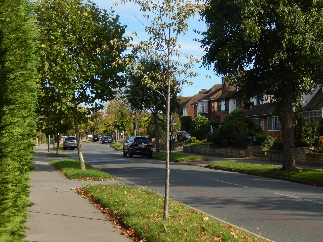

Cabinet approved the Whitgift Estate off Addiscombe Road as a conservation area on 18 November. Woodbury Close is in it after residents asked to be included.
Updated 19 November: Cabinet approved the designation on 18 November.
The Whitgift Estate, the 1920s and 1930s garden suburb between Addiscombe Road and Lloyd Park, is now Croydon’s 22nd conservation area.
Croydon’s Executive Mayor and Cabinet approved the designation, with its conservation area statement, on Wednesday 18 November (decision). They had the outcome of the public consultation and an equality impact assessment in front of them (Cabinet report). The estate is in Park Hill and Whitgift ward.
Which streets are included
The conservation area statement lists the streets (Appendix A):
- Grimwade Avenue
- Sandilands
- Woodbury Close
- Fitzjames Avenue
- Mapledale Avenue
- Harland Avenue
- Upfield
- Radcliffe Road, south of Harland Avenue
- Ranmore Avenue
- the south side of Addiscombe Road, between Shirley Park Golf Club and just east of Sandilands
The area is bounded by the tram line and Woodbury Close to the west, Lloyd Park to the south, and Shirley Park Bowling Club and Shirley Park Golf Club to the east. It includes the playing field in the middle of the estate.
Woodbury Close was left out of the first draft. Residents there objected, pointing out that it was part of the original estate and is covered by the Whitgift Estate Residents’ Association, although the railway line partly separates it. The council redrew the boundary to include it, and the approved boundary keeps it in.
What residents said
The consultation ran from 25 March to 15 May 2026 (consultation statement). The council received 57 responses to its online survey and nine more by email.
- 97% of survey respondents strongly supported making the estate a conservation area.
- 79% had no concerns about what designation would mean for them.
- 60% strongly supported the boundary as drawn, and 25% strongly opposed it, mainly Woodbury Close residents who wanted to be included.
Eight of the nine emailed responses supported the plan, including one from Historic England.
Why the council says it qualifies
The land belonged to the Whitgift Foundation from 1596, when Archbishop John Whitgift bought farmland east of Croydon to fund his almshouses and school. It stayed farmland, market gardens and playing fields until the late 1920s.
The 1925 Croydon (East) Town Planning Scheme opened it up for housing. Covenants required plots to average a third of an acre, with detached houses only. The houses that followed were in English vernacular, Art Deco and Moderne styles, by a number of local architects.
The statement says the estate “retains its original character”. It describes it as a high-quality, low-density garden suburb of its era.
What changes for homeowners
Conservation areas are “designated heritage assets” under national planning policy, the report says. Historic England’s guidance, quoted in the report, says designation brings “some important additional controls” over how owners can alter or develop their homes. Any planning application in the area must preserve or enhance its character.
One rule applies to every conservation area. Anyone wanting to cut down or prune most trees must give the council six weeks’ notice first (Town and Country Planning Act 1990, section 211).
The statement lists the changes it sees as threats to the estate:
- uPVC windows replacing originals, and lost front doors and coloured glass
- unsympathetic side extensions and large dormers
- solar panels on front roof slopes
- front gardens paved over, and boundary walls and hedges lost
- new imposing walls and gates
- the demolition and redevelopment of whole houses
Its advice is that changes should match the original as closely as possible and that solar panels should be placed out of sight from the street. The Executive Mayor’s introduction says designation does not mean “preserving the Estate in aspic”.
Historic England’s response suggested the council also consider an Article 4 direction, which would remove more householder rights to build without planning permission. Cabinet did not make one on 18 November. A full appraisal and management plan for the estate is expected to follow later.
Which areas could be next
The report lists the council’s next candidates for conservation area status, in order:
- Croham Park Estate
- Sanderstead Village
- Brighton Road, Purley
- South End, Ye Old Market and St Peter’s Road, South Croydon
- London Road (south end)
- Fairfield Civic Quarter
What it means for you
If you live on one of the streets above, your home is now in a conservation area. Before you replace windows, extend, or cut back a tree, check with the council’s planning team whether you need permission or must give notice.
Sources
- Croydon Council: Cabinet agenda and decisions, 18 November 2026
- Croydon Council: Whitgift Estate Conservation Area Designation, Cabinet report for 18 November 2026
- Croydon Council: Whitgift Estate Conservation Area Statement, Appendix A
- Croydon Council: Whitgift Estate Conservation Area Consultation Statement, Appendix B
Have your say